
I knew that today would be a tough day. There is a long climb that starts right outside the campground. I had been told about it, read about it, and now that I was there, I could see the road angle up as I walked by it around the campground.
Sleeping in the tent was reasonably comfortable. My tent was roomy, the bag was warm, and the pad I slept on was soft enough. The only problem was the noise. I slept fitfully and woke up quite early when another camper packed his kit and left at the first light of day. I waited in the tent until it was 7:30, when the Big Sur Lodge restaurant opened.
The campground was quiet and the sun hadn't reached most of the ground as I took the short walk to the Lodge. The trail to the Lodge goes over the Big Sur River. Here is how it looked from the footbridge that leads to the Lodge.
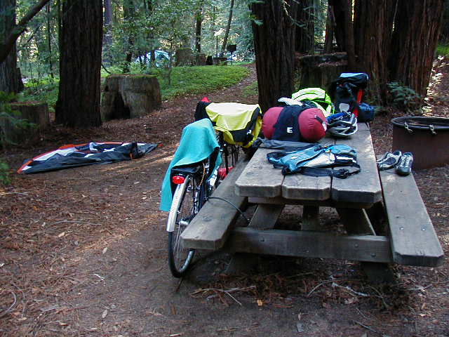
I opted for the full stack of whole wheat buttermilk pancakes with maple syrup and pecan butter. There were four huge pancakes that I tried hard to finish but couldn't quite get all down. I was absolutely stuffed when I returned to the camp site to pack up and get ready to leave. I should have taken this picture before I took down the tent but it didn't occur to me until I had taken down one of the poles.
As I knew about the climb that awaited me, I decided to try and get a bit of warm up by riding north just to get the legs warmed up. I rode a short while and stopped to take a shot of Big Sur in the morning. The power poles are an integral part of the scenery here.

The sound of the Big Sur River running next to the road in the quiet of the morning inspiried this picture.

The information I had gotten about the Big Sur climb was accurate. It was about 2 miles of straight ahead, low gear grind. Since it was early and I had all day to get whereever I was going, I took it slow and stopped to get a picture of the inland view.

The sun was alreaday out full and I needed to removie my arm and leg warmers and put on sun tan lotion. While I was standing by the side of the road, along comes Audi, the Dutch guy I had met two day earlier just south of Half Moon Bay. We rode about the same speed and followed one another up the incline. It was tough. I was tired and covered in sweat when I finally crested the hill.
Audi and I talked as we rested at the top of the hill. He has stopped at Andrew Molera State Park the night before and had some pastry that he was eating for breakfast. I didn't want to wait for him to finish so I took off, figuring I'd see him again somewhere down the road.
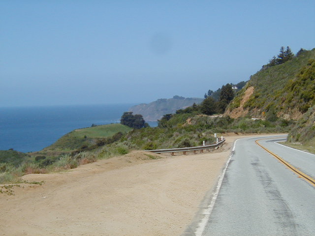
I was able to coast down for a few miles and the road for the next 20 miles would be right on the coast with ups and downs and whole time. As this picture shows, the day was sunny and the view was spectacular.

Here is the view from that same spot, only looking north, along the road I'd just travelled. Note that there is no shoulder.
There was virtually no traffic when I was riding. However, the view down still made me nervous. The guard rail offered no real support as I figured the panniers would act as a lever and simply flip me over it. It is easy to visualize getting clipped by some poorly driven RV (say, when one is coming in each direction), flipping over the rail, and then its bon voyage...

It was in this stretch of the ride that my spirit began to soar. I was all alone, in the full sunshine, riding my bike, on a deserted road. with a spectacular view. I had no place to be and no time to get there. It was a feeling of freedom and joy that I found difficult to contain within my body. It was a bit like floating.
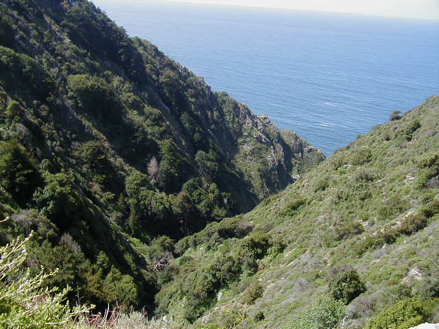
The coast was often cut by a ravine that most likely was some creek's run into the ocean.
I was feeling so good that it was hard not to see everything as wonderful. Here is just such a picture.

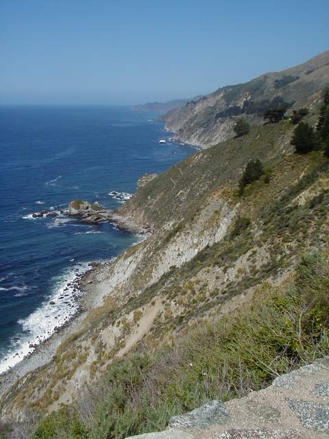
The view up the coast when the road curved around some point was always spectacular.
In addition to the rocks that dot the entire coastline, the color of the water varied from light greet to full blue.
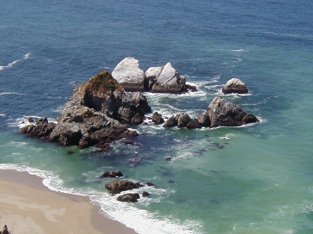
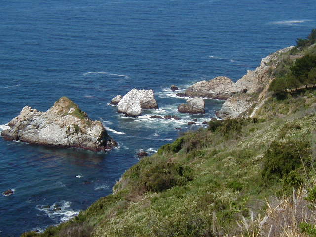
Here's even more coastal rocks.
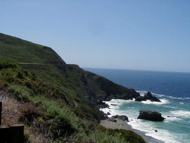
Often, when the road was elevated above the ocean, the view was through trees. It was always inspiring.

This shot is from the same spot as the above photo only I've rotated toward the hills that surround the road and drop to the ocean. Again, note that there is a small shoulder on the road.

There were many isolated beaches that were only good for looking down on. What I liked about this one was the different colors of the water.

This is from the same place looking down the road as it curves around yet another point.
Here is the view looking down from the end of the point shown above.

The green area next to the road was full of wildflowers. The predominent ones were the yellows of the Golden Poppy and purples of several different plants whose name I don't know. I wanted to get a picture but I was often far past them before it registered that some patch would make a nice photo. This bouquet of poppies I saw before I got to them and it turned into one of my favorites pictures of the whole trip.

Here a field of wildflowers right at the water's edge.

Here's a different part of that same field. There was even a scent in the wind!

It was around this part of the ride that I had to make a decision. There was three possible places to stop. One was Kirk Creek campground, which is about 30 miles south of Big Sur. About 5 miles south of Kirk Creek was Plaskett Creek. After Plaskett Creek, it was 35 miles to San Simeon. From my viewpoint, 35 miles from Big Sur to Plaskett Creek was not far enough and all the way to San Simeon was too far.
Before I started, I figured I would make a decision when I got to Plaskett Creek. The real issue was the elevation map that accompanied the Bicycling the Pacific Coast book. It showed two very steep hills between Plaskett Creek and San Simeon that marked the end of the hilly coast. It was flat after these hills but they looked like monsters.
There were two things that made me push on once I got to Plaskett Creek. First, as the day wore one the wind picked up. It was coming from the Northwest and I was banking on using this natural energy to help me the last 20 miles into San Simeon. Second, the elevation map also showed a large hill (around 1000 feet high) going into the tiny town of Lucia. However, when I got there, the town is only 300 feet above sea level. I hoped that the two "M" shaped hills were also exaggerated.
As it turned out, the elevation map was not wrong. The first leg of the "M" was a long winding climb that never levelled out or went down. There was no time to rest without getting off the bike. Every time a car passed me, I could see it, slowly moving up, until it went around some curve and out of view.
Not only was this climb hard because of the grade and the curves, but the wind was quite strong by now and there were eddies that would blow directly in my face as I moved around some of the curves. It was also late in the day and my legs were getting heavy from all the riding I'd done so far.
However, I pushed on; knowing that if I kept peddling I would get to the top eventually. But, the hill kept going up and up and up. In desparation, I finally told the hill god that he was too strong for me and that I would admit that he was stronger than I was. I said this out loud in the hope that the hill god would hear me and place the crest of the hill around the next curve. Through all this, I refused to walk and just kept pushing and wobbling at 4 mph.
While I didn't really have it in me to stop on this climb to take pictures, there were a few times when I did anyway. This picture shows a waterfall that I could hear as I rode along the road but didn't see until I stopped to search for it.

After finding the top of the first hill, there was a steep, scary downhill with the wind blowing me all over the road as I moved around curves. This isn't much of a picture except that it shows how much elevation I had gained, how steep the drop off was, and how windy it was--note all the whitecaps in the ocean. I was real careful, never going above 20 mph on the downhil. I didn't want to get pushed off the road and take the "quick" way down.

On the downhill, I lost about half the elevation. I again dropped it in low gear, kept a steady 4 mph, and beseeched the hill god once more. My legs were aching when I finally found the top of the second tip of the "M." The very end of the Big Sur coast is at Ragged Point.

If you look closely at the left, you can see buildings. Ragged Point is a commercial area with a hotel, gas station, and other amenities. It caters to tour buses and there were several of them parked in the front lot. Again, notice the white caps out in the ocean.
After Ragged Point (where as a young man hitchhiking south, I once spent the night sleeping on the ground without a tent), the coast becomes mercifully flat.

San Simeon was still 20 miles away and I was sore and tired. I managed to keep my mind focused on getting through the next 20 miles. The tail wind was so strong, that at times, without pedaling, I was coasting at 20 mph. It was the only thing that kept me going. Without that wind, I'd never have made it to San Simeon.
I was so tired that after coasting for a while, I couldn't just start pedaling again. I had to begin turning the pedals slowly to allow my legs to respond and get up to speed before they could take any resistance.
The only picture I managed to take was in the middle of a bridge. I have a soft spot for creeks and San Simeon Creek was strong enough to get me to stop and take this photo, eventhough I could barely stand up at this point.

The surrounding area was huge fields full of cows with green hills in the distance. Eventually, the beach was fenced off and seals could be seen covering the beaches. As I had seen seals before and I was tired, I didn't stop to take a picture.
Eventually, I passed the entrance to San Simeon Castle. It was a few short miles to San Simeon Village, a highly commercial strip on both sides of Highway 1 whose main purpose is to give tourists a place to stay as close as possible to Hearst's Castle. On the way into the town, from the north, there is a bridge that goes over a river. While I was crossing it, I remembered that I had slept under this bridge on another hitchhike trip from LA up to Berkeley. And, here I was 25 years later, bicycling on the same bridge, making the same trip, only going south. Even in my exhausted state, I could see the continuity in this moment.
I stopped in San Simeon Village and decided right there to rent a hotel room for the night. What I really wanted was a hot tub. The place I stopped had a pool but no hot tub (as it turned out, I didn't have a bathing suit with me!). I opted to pay $5 more for a room with a bathtub. I soaked for about 40 minutes, slowing rubbing my throbbing thighs.
I washed my biking outfits and hung them up and then went out for dinner. It was very windy and cold and the town was not yet in full tourist mode. I could barely walk. I stopped at the first restaurant I saw: a not very good Italian place. I had eggplant parmesian that fit the definition of a meal. I realized this was the third Italian dinner I'd had in a row and I made a mental note not to eat any more Italian food.
For dessert, I struggled to walk across Highway 1 (which is fenced so that you can only cross it at the ends of the Village) to get an ice cream bar. Then, it was back to the hotel and to sleep.