As I would come to find out, there is a real difference between waking up in a nice cozy bed and in a sleeping bag on the ground. However, that experience was still in the future.
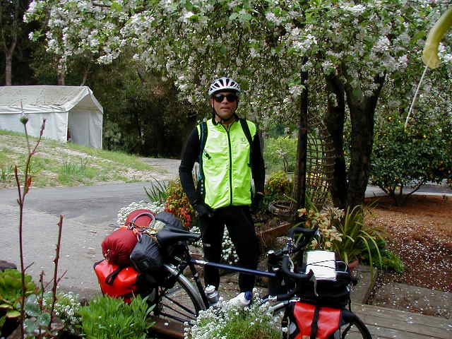
My original plan called for me to take a day off in Aptos to rest after my initial 70 miles ride and just hang out with friends. However, the weather still held out the possibility of rain on Tuesday in Big Sur. In addition, I felt pretty good (especially after a morning hot tub soak), so I decided to push on. After eating a breakfast, of eggs, toast, and OJ, I packed up, loaded the bike and was ready to head out.
In this part of the ride, Highway 1 is a freeway and bikes are prohibited. Instead, the route parallels the freeway on frontage roads for a while and then heads inland over agricultural lands. At about the 10 mile mark, I went over the Pajaro River.

As you can see, the day is overcast, but not as foggy as the previous day. In fact, without the heat of direct sun, it was great cycling weather. The spots you see in the upper right of the photo are swifts who were swooping all over the place.
After another 5 miles of small roads travelled by semi-trucks full of just picked vegetable, the route joins Highway 1. Here, Highway 1 is a two-lane main artery between Santa Cruz and Monterey. While the shoulder is paved and wide, the cars and trucks are constant and going fast. The route goes through Elkhorn Slough. Normally, the Slough is full of birds. However, this day it was full of smelly, green water. I didn't stop to take a picture.
In a couple of miles, just before Castroville (the Artichoke Capital of the World), I turned off Highway 1 and again found myself in among agricultural fields. The fields were often full of pickers who usually returned my waves and smiles. It was nice to be off Highway 1!
The fields gave way to sandy areas that were mostly undeveloped and in a few miles, the route became a bike path that would take me all the way into Monterey (about 15 miles). The bike path went along deserted sandy fields and eventually returned to parallelling Highway 1. The bike path stayed on this course for several miles, the scenery consisting mostly of large sand dunes and the occasional deserted Ft. Ord rifle range. Here is a typcial bike path view. Notice that the weather has cleared and it was now sunny and warm--beautiful cycle touring weather.

I stopped for my first paid meal in Sand City and had a big Chinese meal full of tofu and broccoli that I hoped would last me until Big Sur, 35 miles south.
The bike path continued on through Sand City until I could see Monterey and its Bay in the distance.

Clearly, the bike path has been constructed by hooking together several smaller paths and at times, it isn't always clear where to go. At one point, I had to stop a local rider and ask directions. Like all the other times I did this, the information I got was useful and it was delivered in a friendly manner.
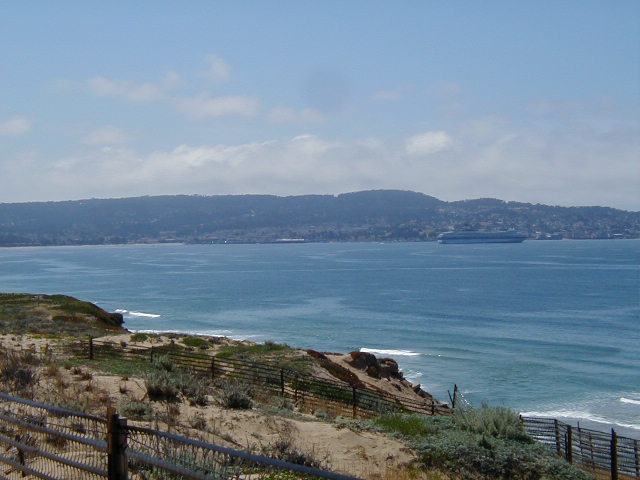
After a brief detour through a mall parking lot, the path again went along the coast, with ever better views of Monterey and its cruise boat visitor.
This picture from the same spot, with a bit of a pivot to the left, shows the bike path and shoreline just north of the city of Monterey.

I then decided to try a complete this panorama by getting a view to the tip of the Monterey peninsula.

The bike path continues on into Monterey proper. As I was not stopping for the night in Monterey, I turned off the path at the Naval Postgraduate School. Going straight would have taken me into Fisherman's Wharf, past the Monterey Aquarium, and into the heart of tourist central.
After riding through a pleasant park, a left turn took me onto old Monterey's main street. Remembering that Monterey was California's first capital, I rode by several named adobe houses identified by signs out front. If one was spending the night in Monterey, a foot tour of this area would probably be pleasant.
After a short ride through this crowded area, I started a long, steady climb past many motels on my side of the road and an large undeveloped plot of land opposite. At the top of the climb, just past the Del Monte shopping center, I went over the, now freeway, Highway 1 and made a fateful right turn up the steepest road I'd encountered so far. I struggled up this road to a curve, hoping it was the top and saw to my horror that it got even steeper and went up a long way. Losing heart, I stopped the bike, dismounted, and started pushing. I discovered that I could push my bike at 3.4 MPH. After about 100 feet of pushing, I noticed a path off to the right that was the bikepath I was seeking. Had I known the path was that close, I doubt I would have gotten off the bike. This was the only time during the entire trip that I walked the bike.
The path goes through a very pleasant, tree-lined lane that is above Highway 1.

At the end of the path, I again crossed over Highway 1 and made a left turn in busy traffic (it was getting close to rush hour) onto Highway 1. From there, it was a steep downhill riding on a narrow shoulder in bumper-to-bumper traffic. It was a bit scary but not dangerous.
At the bottom of the hill, virtually all of the (commute) traffic turns left to go into Carmel Valley. There is also a major shopping center here, which is the last chance to buy anything until Big Sur. Just past there, I passed the Carmel River and then the Carmel River State Beach, with its view back to Carmel (the foreground) and the other side of Monterey (the background).

At the southern tip of the Monterey bay, two miles or so from the Carmel River, is Point Lobos Ranch State Park. Point Lobos is a rugged bit of coastline the provides glorious views north to Carmel and Monterey, but also contains numerous hiking trails along an undeveloped part of the coast. I highly recommend it to anyone who hasn't ever been there. I've been there many times and decided to press on. <

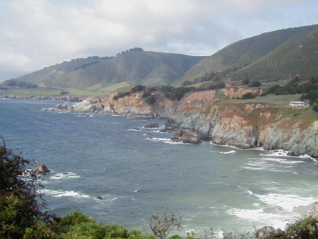
Point Lobos also marks the final transition from Monterey to Big Sur coastline. Officially called Carmel Highlands, the road resumes the familiar up and down of the California coastline. Highway 1 became less travelled and the stunning views of this part of the coast were seen through mature trees.

In this shot, you can make out Monterey and Carmel in the distance.

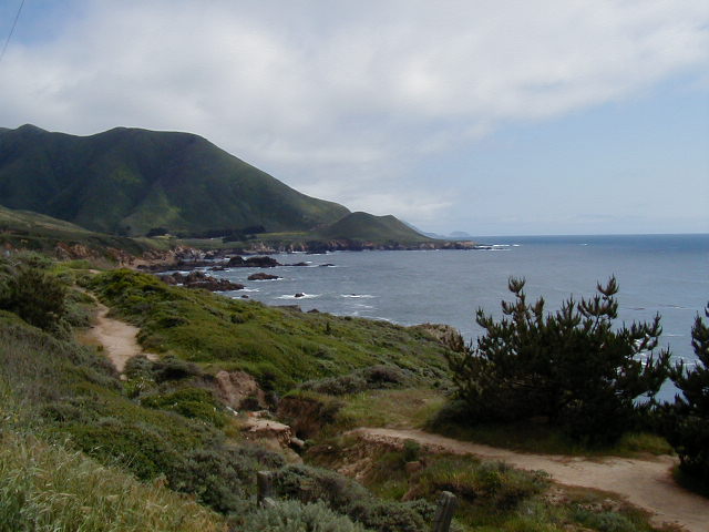
The views of the coast quickly become even more wonderful. I took this picture 15 minutes after the one above.
Luckily, the road goes along the bottom of that hill, not over it. If you look closely, you can see the road in the distance.
Ten minutes later I had made it across the way to the base of the hill and stopped to take a picture looking back.
This picture was taken at the same place but moved to the right to see the hills and the road. Notice that there is only one RV and car in the entire vista. That was about usual for this stretch.

At the end of the above point, I found myself looking out on a shimmering sea. The light balance of this picture is out of whack but it gives some idea of the view.

As it turns out, the point in the above pictures is called Rocky Point. Just around the corner, I stopped at the entrance to the Rocky Point Restaurant and ate a pre-packed avocado sandwich. The wind had picked up, mostly coming from the Northwest, so it was behind me, and it was a bit cool as I stood there pacing around eating a sandwich. The view shows more typical, wonderful coastline. Note that the road is lightly rolling hills and not difficult at all; most anyone could do it!

This is a view from the same spot looking down at the small field that stretched out just below the road.

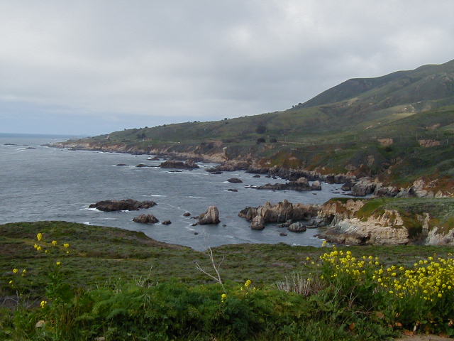
This picture was taken 15 minutes after the one above. The color on the cliffs was breathtaking!
Often, I'd get to the tip of one curve and I'd see a series of curves ahead. In this picture, you see two such curves. Note that I am now quite a way up in the air but that by the curve in the distance, the road is again at sea level.
This picture also shows that dark clouds stuck to the tops of the hills. As the road rose, the sun went away and it got a bit cooler. Also, there were eddys in the wind around the curves. This often lead to treacherous riding. I tried to stop and take a picture at one curve and found that I had real difficulty holding the bike upright while stopped.

Much of the highway is right on the edge of the cliff. Just past the guard rail was a steep drop to the ocean. Here's one view down.

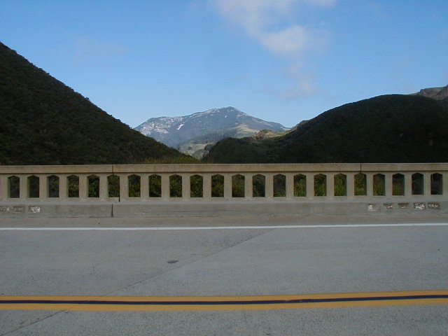
I was a bit surprised by the number of creeks that run out of the hills. Sometimes, I could only hear running water but not see it. Other times, the road went over a bridge that spanned a creek-dug canyon. For the most part, the bridges were narrow. They would be real scary with an RV bearing down on you.

This bridge covers the Little Sur River canyon.

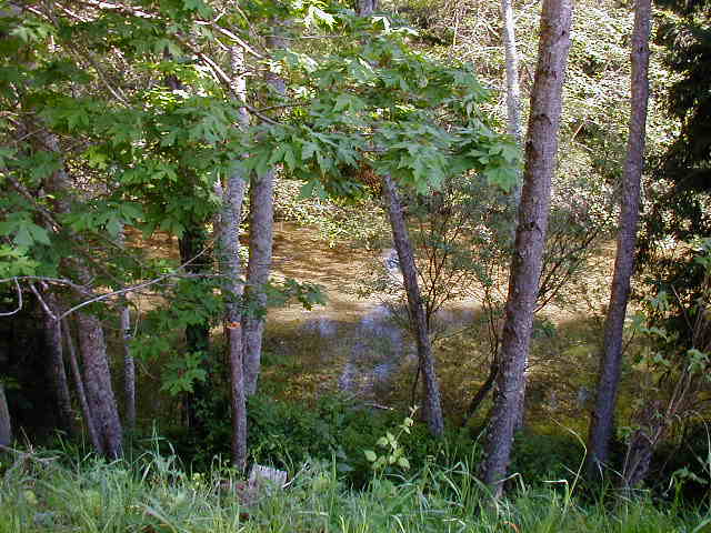
It is easy to spend all the time looking down at the ocean and cliffs. However, the inlands views can also be stunning. This view looks across the bridge, up the Little Sur River Canyon toward mount Pico Blanco.
Point Sur, which sports a non-accessible lighthouse, is just past the Little Sur River.

At Point Sur, the road turns inland to Big Sur.

The ocean no longer crashes next to the highway. Instead, there are green plateaus hosting pasturing cows.

The inland view became tree-lined, lush valleys.

Once the road began moving away from the ocean, the sun came out on full. The first Big Sur campground is Andrew Molera State Park. The information I had said it was a primitive place with no hot showers. I decided to push on to Pfeiffer-Big Sur. I included this picture because I took it without stopping the bike. That is why the sign is a bit out of focus!

It's about 4 miles from Andrew Molera State Park to Pfeiffer-Big Sur. The relatively flat road goes through a valley of redwood trees and the Big Sur River.
This sign announced that I had made it to today's destination.

The Pfeiffer-Big Sur campground is right behind (and over the river from) the Big Sur Lodge, which contains a restaurant. I showered (50 cents for 5 minutes), set-up camp in the Hiker-Biker area ($3/night) and went to dinner. I sat outside as the sun went down. I ate a large pasta dinner, drank lots of water and went through 3 baskets of bread. While its seemed a bit high priced ($14), the simple meal was good and appreciated.
Back at camp, I met a young couple making the same ride I was, more or less. Dave and Toni had started in San Francisco a day before I had and were headed to Santa Barbara. They had taken the 17-mile drive around Monterey so had missed the killer hill separating Carmel from Monterey. They were cooking up dinner, so after a few minutes, I return to my tent and went to sleep.